Overview
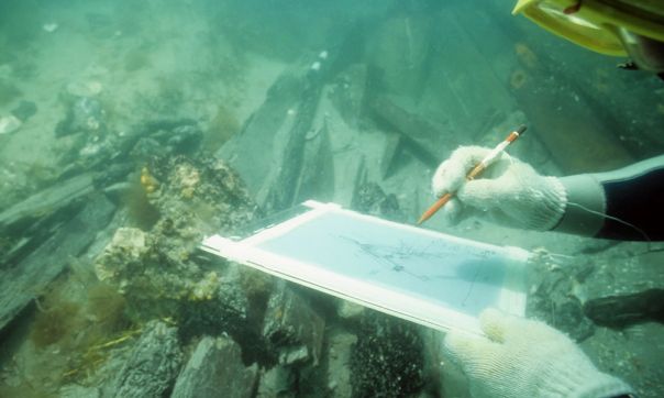
Victoria’s underwater heritage includes impressive sunken submarines, steamships and ferries, a silent fleet scuttled in deep graveyard waters, well-preserved hulls of wooden sailing ships supporting spectacular marine life in Port Phillip Bay, and the remains of small ships and large sailing vessels scattered along the coast.
There are around 660 shipwrecks along the Victorian coastline, but only about 300 have been found. You can dive on most of them without permission. All are protected by law.
Maritime heritage protection
There are two sets of protection for maritime heritage in Victoria.
Shipwrecks, aircraft wreck sites and artefacts
The Underwater Cultural Heritage Act 2018 protects shipwrecks, aircraft wreck sites, and artefacts along Victoria’s coast. The Heritage Act protects shipwrecks and shipwreck artefacts in coastal waters. Coastal waters include Port Phillip, Westernport, and Victorian rivers. Some maritime infrastructure sites like jetties, sea walls and mooring dolphins are also protected.
There are about 390 recorded wrecks protected under the Commonwealth legislation. To find out if a wreck is listed under the Underwater Cultural Heritage Act, search the Australasian Underwater Cultural Heritage Database.
There are about 260 recorded wrecks protected under the Heritage Act. To find out if a shipwreck is listed under the Heritage Act, use the Advanced Shipwreck Search.
Maritime infrastructure
Additionally, there are hundreds of maritime infrastructure sites protected under the Heritage Act. These sites are listed in the Victorian Heritage Inventory. To find out if maritime infrastructure is listed under the Heritage Act, use VicPlan or search by property address.
You are required to report any shipwreck that you identify.
Protected zones
Protected zones are no-entry zones around some wreck sites in Victoria. They provide extra protection for significant and fragile wrecks. Both the Victorian and Commonwealth law allows for the declaration of protected zones. There are 10 protected zones in Victoria.
Protected zones vary in size and very few are identified by pylons or danger marks. All protected zones are marked on most navigational software, and on the following charts:
- AUS 143 Port Phillip
- AUS 144 The Rip
- AUS 155 Approaches to Port of Melbourne
- AUS 157 Port of Geelong and Approaches
- AUS 181 Corner Inlet
- AUS 357 South East Point to Point Hicks
- AUS 801 Cape Schanck to Cape Liptrap
It is an offence to enter, anchor, trawl, fish or dive in a protected zone without a permit. It’s the responsibility to boat operators to know where the zones are and avoid them.